






The story so far: The Indian Space Research Organisation (ISRO) is planning to launch the NISAR satellite from Sriharikota on July 30 onboard a GSLV Mk-II rocket. ‘NISAR’ stands for NASA-ISRO Synthetic Aperture Radar and is a joint mission of the two space agencies. It is a sophisticated earth-observation satellite designed to study changes on the earth’s surface in fine detail, covering earthquakes, volcanoes, ecosystems, ice sheets, farmland, floods, and landslides.
What’s the need for NISAR?
NISAR is the first major earth-observing mission with a dual-band radar, which will allow it to observe changes more precisely than any other satellite. It will be able to see through clouds, smoke, and even thick vegetation, both at day and night, in all weather conditions. The three-tonne machine has been a decade in the making and costs more than $1.5 billion, also making it one of the most expensive earth-observing satellites to date.
The earth’s surface is constantly changing. Natural disasters, human-driven changes, and climate shifts all affect environments and human societies. Satellites provide critical information by taking snapshots of these changes from space, helping scientists, governments, and relief agencies prepare for, respond to or study them. To this end, NASA and ISRO have created a powerful global mission that also allows ISRO guaranteed access to a stream of high‑resolution data tailored to India’s needs.
NISAR’s science and application goals span six areas: solid earth processes, ecosystems, ice dynamics, coastal and ocean processes, disaster response, and additional applications (including tracking groundwater, oil reservoirs, and infrastructure like levees, dams, and roads for subsidence or deformation and supporting food security research).
The planned mission lifetime is three years although its design lifetime is at least five years. Notably, the mission’s data policy entails that the data NISAR produces will be freely available to all users (typically) within a few hours.
How does NISAR work?
Once it is launched, NISAR will enter into a sun-synchronous polar orbit at 747 km altitude and an inclination of 98.4º. From here, instead of snapping pictures, NISAR’s synthetic aperture radar (SAR) will bounce radar waves off the planet’s surface and measure how long the signal takes to come back and how its phase changes.
The ability of a radar antenna to resolve smaller details increases with its length, called its aperture. In orbit, deploying an antenna hundreds of metres long is impractical. SAR gets around this by mimicking a giant antenna. As the spacecraft moves forward, it transmits a train of radar pulses and records the echoes. Later, a computer coherently combines all those echoes as if they had been captured simultaneously by one very long antenna, hence the “synthetic aperture”.
NISAR will combine an L-band SAR (1.257 GHz), which uses longer-wavelength radiowaves to track changes under thick forests and soil and deformations on the ground, and an S-band SAR (3.2 GHz), which uses shorter-wavelength radiowaves to capture surface details, such as crops and water surfaces.

Although NISAR will operate globally at L‑band, ISRO has reserved routine, planned acquisitions with the S‑band SAR over India. The latter acquisitions have extended sensitivity to biomass, better soil‑moisture retrieval, and mitigate ionospheric noise — all capabilities tuned to India’s needs in agriculture, forestry, and disaster management.
Because the L‑band radar is the principal tool for NASA’s mission goals, the instrument is expected to operate in up to 70% of every orbit. This said, operating both radars together is an official implementation goal so that mode conflicts over the Indian subcontinent are minimised.
Polarisation is the direction in which the electric field of some electromagnetic radiation, like radiowaves, oscillates. SAR can transmit and receive radar signals with horizontal or vertical polarisation. Using different combinations will allow the instruments to identify the structure and types of different surface materials, like soil, snow, crop or wood.
The swath width, i.e. the breadth of the bands on the ground the SARs will scan, is an ultra-wide 240 km. The radars’ SweepSAR design will transmit this beam and, upon its return, digitally steer multiple small sub‑apertures in sequence, synthesising beams that sweep across the ground track. This scan‑on‑receive method allows the 240‑km swath without compromising resolution.
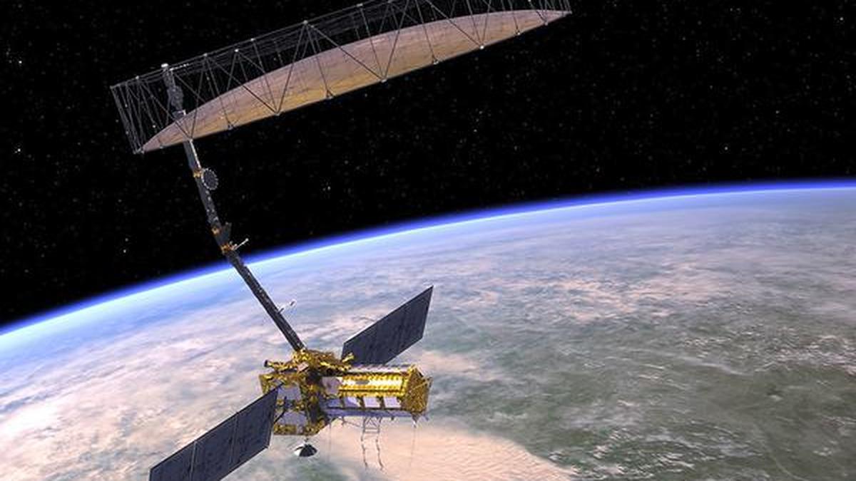
The resulting scans will have a spatial resolution of 3-10 m and centrimetre-scale vertical mapping — enough to spot impending land subsidence in cities, for example — depending on the mode. Each spot on the ground will be scanned once every 12 days.The satellite also features a large 12-m-wide mesh antenna.
NISAR will produce annual maps of aboveground woody biomass of 1 ha resolution and quarterly maps of active and inactive cropland. High-resolution maps of flooded versus dry areas will be available as well. During a disaster, NISAR can also be directed to collect data for ‘damage proxy maps’ to be delivered in under five hours.
This said, for certain acquisition modes, NISAR won’t be able to achieve full global coverage at the highest resolution. Above roughly 60º latitude, every alternative observation will be skipped due to converging ground tracks. Similarly, some 10% of the surface may not be mapped from either direction (of the satellite’s passage over the ground) in any given 12-day cycle.

How was NISAR built?
At the time the two space organisations agreed to build NISAR, NASA and ISRO decided each body would contribute equivalent‑scale hardware, expertise, and funding. ISRO’s contributions in particular are mission‑critical.
The organisation supplied the I‑3K spacecraft bus, the platform that houses the controls to handle command and data, propulsion, and attitude, plus 4 kW of solar power. The same package also included the entire S‑band radar electronics, a high‑rate Ka‑band telecom subsystem, and a gimballed high‑gain antenna. The S‑band electronics were designed and built at the Space Applications Centre in Ahmedabad.
NASA’s biggest contribution was the complete L‑band SAR system. NASA’s Jet Propulsion Laboratory supplied all radio‑frequency electronics, the 12‑m antenna, a 9-m carbon-composite boom, and the instrument structure that carries both radars. The agency also fabricated the L‑band feed aperture and provided the supporting avionics, including a high‑capacity solid‑state recorder, a GPS receiver, an autonomous payload data system, and a Ka‑band payload communications subsystem.
The spacecraft was to be integrated at the ISRO Satellite Centre in Bengaluru after the two radars were mated at JPL. The final observatory‑level tests will therefore have taken place on Indian soil. After that the mission will lift off from Sriharikota onboard a GSLV Mk-II launch vehicle, with ISRO providing end‑to‑end launch services and documentation.
While themission operations are to be centred at the JPL Mission Operations Center, day‑to‑day flight operations will be led from the ISRO Telemetry, Tracking and Command Network in Bengaluru. Once NISAR is in orbit, most of its data will be sent through NASA’s Near Earth Network facilities in Alaska, Svalbard (Norway), and Punta Arenas (Chile), which can together receive around 3 TB of radar data per day. They will be complemented by ISRO’s ground stations in Shadnagar and Antarctica.
After the raw data arrive, India’s National Remote Sensing Centre will process and distribute all products required for Indian users, mirroring NASA’s pipeline.