



Say you’re on a desert island on a quest for buried treasure. You’ve lost your map and run out of clues. Now you have two options: you could walk around with a shovel, digging holes at random and hoping for the best, or you could fly a drone overhead equipped with special cameras that can ‘see’ through the sand or detect the magnetic pull of valuable coins.
This isn’t a pirate move but an existing technology called remote-sensing. It’s what engineers and scientists use to map the earth’s resources without ever touching the ground. From tracking the health of a forest to finding water deep underground, their satellites and drones are changing the way humans understand our planet.
What is remote-sensing?
Our eyes only see visible light, e.g., the colours of the rainbow. But the sun emits many other types of electromagnetic energy that we can’t see, like infrared and ultraviolet light.
Everything on the earth, including the rocks, the water, the trees, etc., reflects these energies differently. The reflections are called spectral signatures; they are sort of like the fingerprint of the materials these objects are made of.
By studying this light, a sensor installed onboard a satellite can look at a patch of ground and say, “This reflects a lot of near-infrared light but absorbs red light. Therefore, it must be a healthy plant.” This is the basic idea of remote-sensing.
What do different materials ‘look’ like?
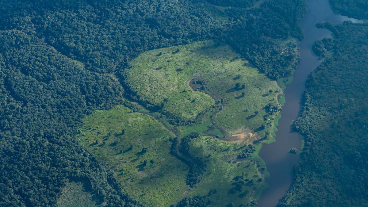
Farmers and forest rangers use satellites to check the health of plants. Healthy leaves are full of chlorophyll, which absorbs red light for photosynthesis and reflects near-infrared light to avoid overheating.
Scientists use a formula called the normalised difference vegetation index to determine if a plant is healthy based on its spectral signatures. If a satellite observes high near-infrared reflection, the crops are healthy. If the reflection of that part of the spectrum drops, the plants might be thirsty or sick.
According to a review published in the Journal of Plant Ecology in 2008, by analysing the spectral signatures, researchers can distinguish between different plant communities and tree species across entire forests.
Such mapping is the first critical step in calculating the biomass of a forest, which is essentially weighing the trees from space, to understand how much carbon they are storing to help fight climate change.
How do satellites map water?
To map water bodies from space, scientists mainly use two complementary techniques: optical indexing, using reflected sunlight, and synthetic aperture radar, using active radio waves.
The optical indexing technique makes use of the fact that water reflects visible green light, which is why deep water often looks blue-green, but strongly absorbs near-infrared and shortwave infrared light. These readings are combined in the normalised difference water index (NDWI).
This way, in remote-sensing data, the index has a high positive value over water bodies and a negative value over land. A newer version called modified NDWI, or MNDWI, uses only shortwave infrared light. This is often preferred in cities because it’s better at distinguishing between water and the shadows cast by tall buildings.
Of course, optical cameras have a weakness: they can’t see through clouds or at night. To map water in these conditions, including floods during a storm, scientists use synthetic aperture radar (SAR). To understand how this technology works, please see The Hindu article ‘What makes the NASA-ISRO SAR satellite so special?’, dated July 27, 2025.
In SAR’s gaze, surfaces like soil, grass, and buildings — which scatter radio waves in all directions — look bright. Calm water, however, is very smooth, almost like a mirror, and looks pitch black. So by looking for these black matches in a radar image, scientists can map floodwaters even through a cyclone.
Satellites can also estimate water quality. Muddy water reflects light differently than clear water, and water full of algae has a specific spectral signature. This helps environmentalists track pollution or harmful algal blooms.
So much for features above the earth’s surface; how do scientists and engineers use satellites to find what’s underground?
How do satellites map subsurface features?
Experts look for clues on the surface or use different types of physics.
Valuable minerals like copper, gold, and lithium often form deep underground, but geological forces push some of them to the surface over millions of years. Even if they’re just traces in the soil, hyperspectral sensors can find them.
When sunlight strikes an object, it’s reflected. A normal camera may group that reflection into a combination of three main colours: red, green, and blue, e.g. a hyperspectral sensor uses a prism or grating to split that light into hundreds of very narrow, continuous colours and measures the intensity of light at every single frequency across the spectrum.
As a result these sensors can create a spectral signature for every pixel in the image.
So while a ‘normal’ satellite might look at a forest and say, “This is green. It’s a tree”, a hyperspectral sensor could look at the same forest and say, “This is a banyan tree. It has a nitrogen deficiency. And the rock next to it is limestone, not granite.”
According to a 2023 study in Ore Geology Reviews, geologists also use these sensors to even map alteration zones, areas where heat and fluids from deep underground have changed the chemistry of surface rocks.
Oil and gas are trapped deep in the earth but small amounts often leak upwards through very small cracks, a process called micro-seepage. When this gas reaches the surface, it changes the soil chemistry and can even turn the leaves of plants slightly yellow, by stressing them out.
Satellites can detect these subtle changes in vegetation health and soil colour, giving exploration companies a sense of where to drill.
What if there isn’t micro-seepage?
If there’s no seepage, there’s no way satellites’ sensors can ‘see’ the oil or gas directly. However, satellites are still crucial in these situations because, instead of looking for the oil, geologists use satellites to look for the container holding the oil.
Oil and gas don’t just lie in big underground lakes, they’re also trapped in the pores of rocks and are usually naturally squeezed into specific shapes called traps. The most common trap is an anticline, where rock layers curve upwards like a dome or an arch.
NASA’s Landsat satellites or Japan’s Advanced Spaceborne Thermal Emission and Reflection Radiometer (ASTER) sensor onboard NASA’s Terra satellite take pictures of exposed rock layers on the earth’s surface. And if geologists see layers on the surface that are folded into the shape of a dome, there’s a good chance they’re folded the same way deeper underground.
Another technique makes use of the fact that oil forms when organic materials are buried deep and ‘cooked’ by the earth’s heat for millions of years. This happens in deep depressions called sedimentary basins.
Over the oceans, satellites measure the height of the sea surface with incredible precision. Large underwater geological structures, which might contain oil traps, have a gravitational pull that actually piles water up above them. By mapping these bumps in the ocean, scientists can map the rock structures below the seafloor.
Oil is found in sedimentary rock like sandstone or limestone, which is generally not magnetic. However, the basement rock deep below it, such as granite or volcanic rock, is magnetic. So satellites measure the earth’s magnetic field to find where the magnetic basement is very deep.
And where the basement is deep, it means there could be a thick layer of sedimentary rock on top, with the prospect of oil. In effect, when there’s no micro-seepage, satellites can’t say “there’s oil here” but rather that “there’s a geological structure here capable of holding oil”.
How do satellites track groundwater?
Since water is heavy, a large underground aquifer actually has a stronger gravitational pull than dry rock.
From 2002 to 2017, NASA operated its Gravity Recovery and Climate Experiment (GRACE) mission with two satellites that chased each other around the earth. When the lead satellite flew over a heavy underground aquifer, gravity would pull it slightly faster, changing the distance between the two satellites.
By measuring this change in distance, scientists could weigh the water underground.
One famous 2009 study published in Nature used GRACE data to show that groundwater levels in North India were dropping at alarming rates because they were being extracted to irrigate crops.
Remote-sensing makes resource exploration faster, cheaper, and more environmentally friendly. Instead of drilling thousands of holes to find oil or water, we can target specific areas.
It also helps us protect resources: by monitoring forests and aquifers from space, we can ensure we aren’t using them up faster than nature can replenish them.